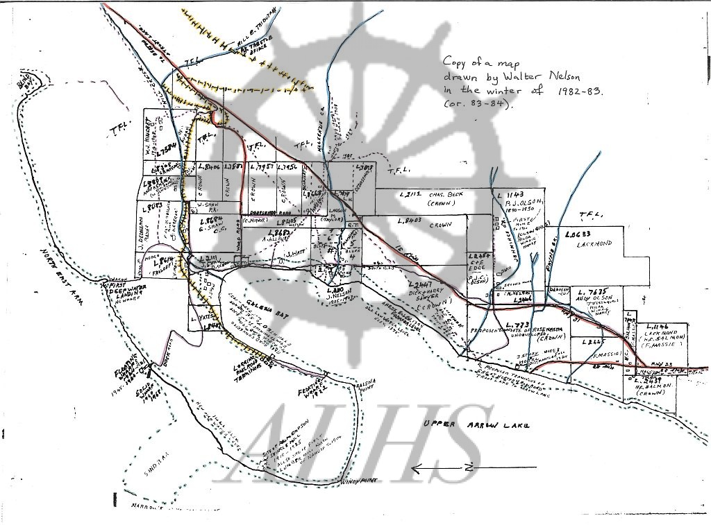
: Map of Galena Bay settlement drawn by lifelong Galena Bay resident Walter Nelson, drawn between 1982-1984. Map shows historic property owners, location of historic ferry landings and wharves, and the location of the proposed townsite of Rosenheim, as well as original shoreline before 1968-69 flooding of Upper Arrow Lake by Hugh Keenleyside Dam.
Purchase Print
Purchased images are for personal use only and not for resale or redistribution. To obtain a licensing agreement please contact: [email protected].