Accession Num: 2023.002.001.2
Negative Code:
Extent:
Document Date: 1945-- - 1965--
Donors: Fauquier Communication Centre Society
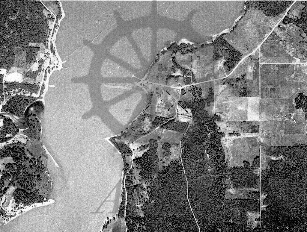
Keywords: aerial image, ferry, Lower Arrow Lake, Needles-Fauquier Ferry, and The Needles
Locations: Fauquier and Needles
Physical Description:
1 photograph : b/w ; 27.9 x 21.6 cm
Notes:
An aerial image of the communities of Needles (left) and Fauquier (right) at the north end of Lower Arrow Lake, ca. mid-20th century. The image is a detail of photograph 2023.002.001.1. Highway 6 runs through the Fauquier townsite at top right leading to the Needles-Fauquier ferry that crossed the lake at centre. The Needles (sandspit formations) are at bottom left. Applegrove Road runs through the image from centre toward the bottom (south). Image via Bill Laux, Fauquier.