Accession Num: 2023.002.001.1
Negative Code:
Extent:
Document Date: 1945-- - 1965--
Donors: Fauquier Communication Centre Society
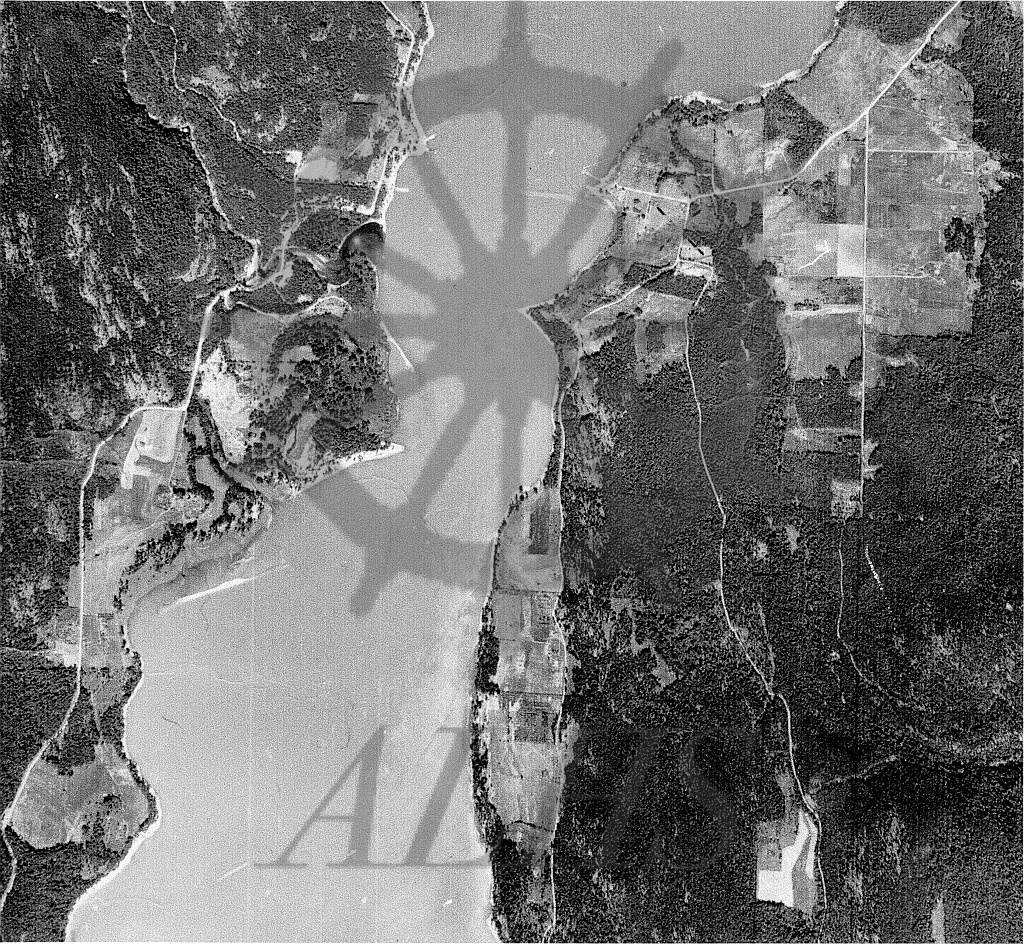
Keywords: aerial image, ferry, Lower Arrow Lake, Needles-Fauquier Ferry, The Needles, and Whatshan River
Locations: Fauquier and Needles
Physical Description:
1 photograph : b/w ; 27.9 x 21.6 cm
Notes:
An aerial image of the communities of Needles (top centre left) and Fauquier (top right) and environs along the north end of Lower Arrow Lake, ca. mid-20th century. Lake Drive (the pre-1968 highway between Needles and Edgewood) runs along the west (left shore of the lake). The Whatshan River enters the lake directly south of Needles. Applegrove Road runs along the east (right) shore of the lake. Highway 6 runs through the Fauquier townsite at top right to the Needles-Fauquier ferry at top centre. Image via Bill Laux, Fauquier.