Accession Num: 2021.002.2.2
Negative Code:
Extent:
Document Date: 1990-09-14 - --
Donors: Cheryl Truax
Creators: Harvey Truax
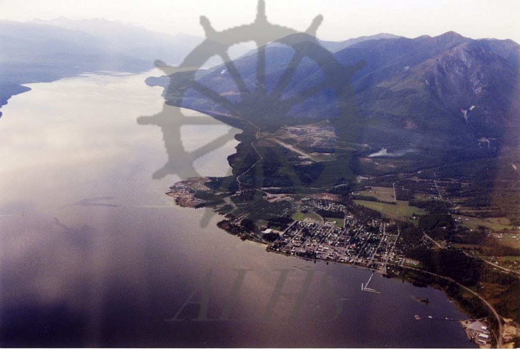
Keywords: 1990s, 408 Tactical Helicopter Squadron, aerial image, airport, Highway 23, Kuskanax Creek, Kuskanax Mountain, Kuskanax Point, Mount Abriel, Nakusp Airport, Nakusp Recreation Park, and Upper Arrow Lake
Locations: Glenbank and Nakusp
Physical Description:
1 colour photograph (15.1 cm x 10.2 cm)
Notes:
Aerial view of Nakusp (below centre), Glenbank (right), Upper Arrow Lake, and Kuskanax Creek delta, 14 September 1990. View is looking north. Highway 23 runs along lakeshore. Nakusp Airport at centre. Mount Abriel at top centre. Kuskanax Mountain at top right. Photo taken by Harvey Truax of Nakusp aboard a 408 Tactical Helicopter Squadron helicopter.