Accession Num: 2018.027.9.11
Negative Code: P25-9
Extent:
Document Date: 1968-05-13 - --
Donors: Wilf Hewat
Creators: Wilf Hewat
Keywords: 1960s, aerial image, Arrow Lakes Drive, Arrow Lakes flooding (Columbia River Treaty), BC Hydro, Broadwater Road, Columbia River, dam, dam construction, Hugh Keenleyside Dam, and Lower Arrow Lake
Locations: Castlegar and Robson
Physical Description:
1 colour slide (35 mm)
Notes:
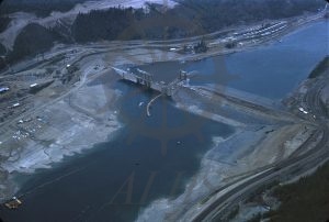
Aerial view, High Arrow Dam (later Hugh Keenleyside Dam) under construction, Columbia River west of Robson, 13 May 1968. Lower Arrow Lake impounded toward bottom left. Broadwater Road at top. Arrow Lakes Drive at bottom right.
