Accession Num: 2018.027.12.13
Negative Code: P27-13
Extent:
Document Date: 1969-09-10 - --
Donors: Wilf Hewat
Creators: Wilf Hewat
Keywords: 12 Mile Road (Hudson's Hope), 1960s, aerial image, Dunlevy Creek, farms, Josef Road, Peace Reach, and Williston Lake
Locations: Hudson's Hope
Physical Description:
1 colour slide (35 mm)
Notes:
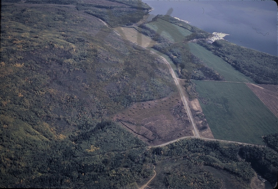
Aerial view, farm on north shore of Peace Reach (formerly part of Peace River), Williston Lake, 12 Mile Road 25 kilometres west of downtown Hudson's Hope, 10 September 1969. View is looking southeast. East side of Dunlevy Creek estuary (future Dunlevy Recreation Area) at bottom. 12 Mile Road runs from top of image to Josef Road at bottom.