Accession Num: 2016.003.207.42
Negative Code:
Extent:
Document Date: 1981-- - --
Donors: Milton Parent
Creators: Milton Parent
Keywords: 1980s, aerial image, Billings Road, Brouse Loop Road, farms, Kangaroo Trail, and The Assart (Waterfield home/farm)
Locations: Crescent Bay
Physical Description:
1 colour photograph (15.0 cm x 10.1 cm)
Notes:
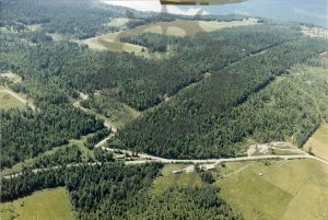
Aerial view of Crescent Bay looking southwest, 1981. Southwest end of Brouse Loop Road runs through image at bottom. Billings Road runs diagonally across image from Brouse Loop Road to top right of photo. Kangaroo Trail at centre left. Waterfield farm pasture at top centre.
