Accession Num: 2016.003.207.29
Negative Code:
Extent:
Document Date: 1981-- - --
Donors: Milton Parent
Creators: Milton Parent
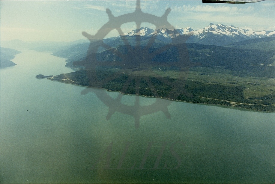
Keywords: 1980s, aerial image, Bannock Creek, Highway 23, Mount Burnham, Mount Odin, Mount Thor, and Upper Arrow Lake
Locations: Shelter Bay
Physical Description:
1 colour photograph (15.0 cm x 10.1 cm)
Notes:
Aerial view, west shore of Upper Arrow Lake north of Shelter Bay, 1981. Bannock Point and Shelter Bay at centre left. Highway 23 runs along lakeshore. Valley of Bannock Creek runs above centre. Gold Range (specifically Mount Burnham, Mount Odin, and Mount Thor) in background.