Accession Num: 2014.003.6078
Negative Code: G14-7
Extent:
Document Date: 1960-- - 1966--
Donors: City of Vancouver Archives
Creators: BC Hydro
Keywords: 1960s, aerial image, Columbia River, Sand Island, and The Narrows
Locations: Carrolls Landing, East Arrow Park, Grahams Landing, and Makinson
Physical Description:
1 b/w negative (35 mm)
Notes:
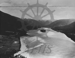
Aerial view of The Narrows, Columbia River, looking south toward Burton over top of Sand Island at centre, 1960s. East Arrow Park at bottom left. Makinson and Carrolls Landing at centre left. Grahams Landing at centre right.
