Accession Num: 2014.003.4730
Negative Code: E27-9
Extent:
Document Date: 1945-- - 1965--
Donors: Curry Morton
Keywords: aerial image, Columbia River, Dispatch Island, farms, Highway 6, Morton Ranch, The Narrows, and Upper Arrow Lake
Locations: East Demars and West Demars
Physical Description:
1 b/w negative (35 mm)
Notes:
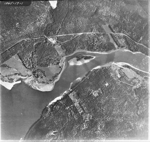
Aerial view of Upper Arrow Lake entering The Narrows, Columbia River, at Demars, mid-20th century. East Demars is at top; West Demars is at bottom. Dispatch Island at centre. Morton Ranch at centre left. Highway 6 runs above East Demars near top.
