Accession Num: 2014.003.1720
Negative Code: B40-5
Extent:
Document Date: 1952-- - --
Donors: John Grigg
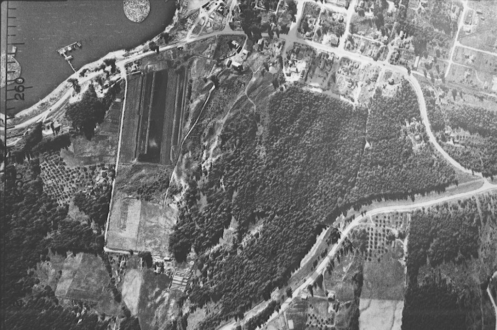
Keywords: 1950s, aerial image, Canadian Pacific Railway, farms, Government Hill, Government Hill Road, Highway 6, Nakusp & Slocan Railway, Nelson Avenue, Spicer Farm, Upper Arrow Lake, and White's Hill
Locations: Glenbank and Nakusp
Physical Description:
1 b/w negative (35 mm)
Notes:
Detail of 1952 forestry air photo of Nakusp focusing on easternmost Nakusp (Nelson Avenue, Spicer Farm, Government Hill, and White's Hill). North is at right. Upper Arrow Lake at top left. Spicer Farm at left. Highway 6 enters image from left (south) along lakeshore onto Nelson Avenue (top centre) and then up Government Hill (centre right), crossing Nakusp & Slocan (Canadian Pacific) Railway into Glenbank, turning up White's Hill (bottom).