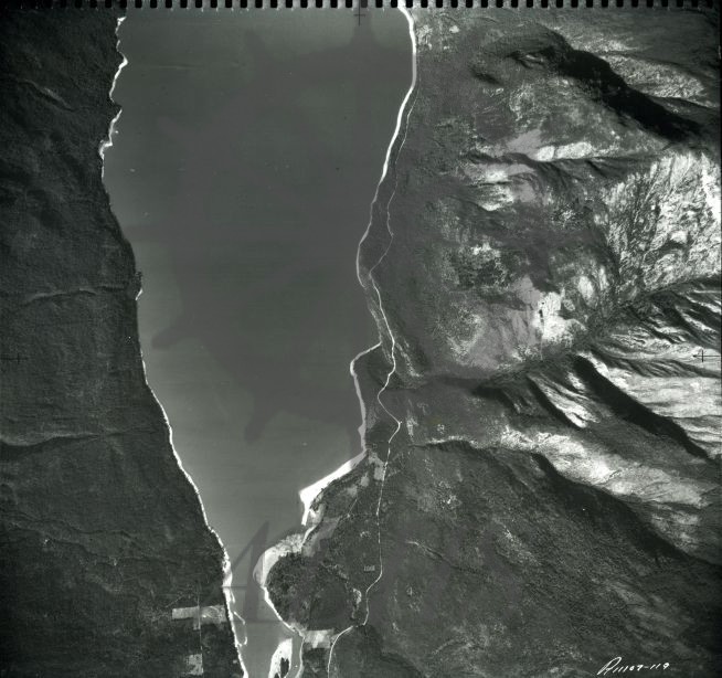
Accession Num: 2007.008.1
Negative Code:
Extent:
Document Date: 1940-- - 1947--
Donors: Val Morton
Creators: Department of Energy Mines and Resources
Keywords: aerial image, Columbia River, McDonald Creek, Morton Ranch, The Narrows, and Upper Arrow Lake
Locations: East Demars and West Demars
Physical Description:
1 b/w photograph (21.6 x 24.1 cm)
Notes:
Department of Energy, Mines and Resources air photo of south end of Upper Arrow Lake (West Demars & East Demars) showing Slewiskin Creek entering lake and Lots 7106 & 8035 (Morton Ranch), taken 1947 or before. Photo no. A11107-119