Accession Num: 1999.019.442
Negative Code: M27-9
Extent:
Document Date: 1968-07-24 - --
Donors: Estate of Jean Spicer
Creators: Jean Spicer
Keywords: 1960s, aerial image, Arrow Lakes flooding (Columbia River Treaty), Bjorkland mink farm, Celgar (Columbia Cellulose/Canadian Cellulose), farms, Highway 6, road construction, Rothwell Bay, Spicer Farm, and Upper Arrow Lake
Locations: Glenbank and Nakusp
Physical Description:
1 colour slide (35 mm)
Notes:
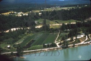
Aerial view of Spicer Farm, Nakusp, 24 July 1968. Original alignment of Highway 6 South and Rothwell Bay (Upper Arrow Lake) at bottom. Paul Bjorkland house at top and Celgar offices at right. New Highway 6 South under construction at centre in advance of flooding from BC Hydro the following the year. Glenbank and Highway 6 East at top.
