Accession Num:
Negative Code:
Extent:
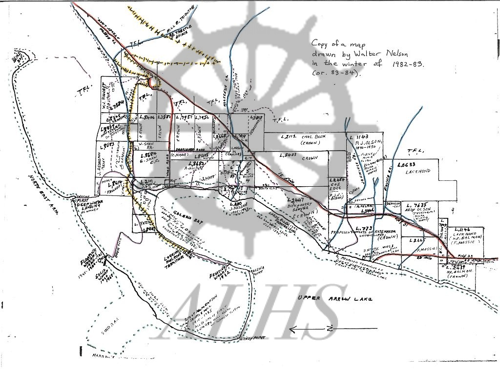
Document Date: 1982-11- - 1984-03-
Donors: Marilyn Taylor
Creators: Walter Nelson
Keywords: 1980s, Galena Bay wharf (pre-1968), Galena landing (pre-1968), map, Nelson; Walter Scott, Northeast (Beaton) Arm, Storm Point/The Thumb, and Upper Arrow Lake
Locations: Galena Bay
Physical Description:
1 colour illustration (4400 x 6800 pixels)
Notes:
Map of Galena Bay settlement drawn by lifelong Galena Bay resident Walter Nelson, drawn between 1982-1984. Map shows historic property owners, location of historic ferry landings and wharves, and the location of the proposed townsite of Rosenheim, as well as original shoreline before 1968-69 flooding of Upper Arrow Lake by Hugh Keenleyside Dam.