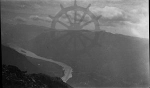
Accession Num: 970.32.1.22
Negative Code: O17-8
Extent:
Document Date: 1929-- - 1933--
Donors: Charlie Slade
Creators: Charlie Slade
Keywords: 1930s, Columbia River, Mosquito Creek, Mount Ingersoll, Sand Island, Scalping Knife Mountain, and The Narrows
Locations: Arrow Park, Carrolls Landing, East Arrow Park, Grahams Landing, and Saddle Mountain
Physical Description:
1 b/w negative (14.0 cm x 8.5 cm), 1 b/w photograph (14.4 cm x 9.0 cm)
Notes:
The Narrows (Columbia River) and Mount Ingersoll as seen from Scalping Knife Mountain, ca. 1929-1933. Arrow Park at bottom centre with East Arrow Park at left across river. Arrow Park (Mosquito) Creek valley at bottom right. Carrolls Landing (left bank), Sand Island, and Grahams Landing (right bank) at left centre. Burton (left bank) and Bellevue (right bank) located at riverbend beyond Sand Island.
