Accession Num: 2022.009.2.40
Negative Code: R37-47D
Extent:
Document Date: 1967-- - --
Donors: Estate of Florence Adshead
Creators: Florence Adshead
Keywords: 1960s, Arrow Lakes flooding (Columbia River Treaty), Columbia River, farms, Joe & Florence Adshead farm (Makinson), Sand Island, and The Narrows
Locations: Grahams Landing and Makinson
Physical Description:
1 photograph : col. slide ; 35 mm
Notes:
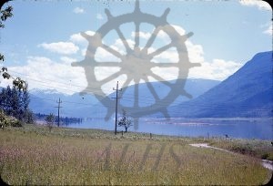
View from Joe Adshead & Florence Adshead farm, Makinson, looking south across levelled Sand Island after the island was cleared of vegetation in advance of BC Hydro's flooding of the Arrow Lakes valley, The Narrows, Columbia River, 1967. Shoreline at Grahams Landing cleared across The Narrows at right.
