Accession Num: 2018.012.17
Negative Code: P11-1
Extent:
Document Date: 1967-- - --
Donors: Doreen Desrochers
Creators: Doreen Desrochers
Keywords: 1960s, Arrow Lakes flooding (Columbia River Treaty), Bay Street, Box Mountain, Government wharf (Nakusp), Nakusp waterfront levelling, Rothwell Bay, and Upper Arrow Lake
Locations: Nakusp
Physical Description:
1 colour slide (35 mm)
Notes:
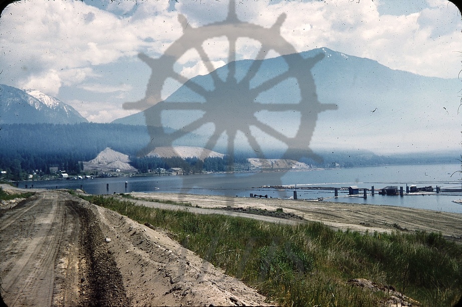
View from west end of Bay Street of Nakusp waterfront following its levelling in advance of construction of concrete erosion barrier as a result of upcoming raising of Upper Arrow Lake by High Arrow Dam, 1967. Government wharf at right. Bay Street runs through centre. Celgar complex at Rothwell Point in background across Rothwell Bay.