Accession Num: 2016.005.88
Negative Code:
Extent:
Document Date: 1909-- - 1911--
Donors: Annette Devlin
Creators: Douglas Ford and James Ford
Keywords: 1910s, Fruit Farming at Edgewood British Columbia (booklet), Inonoaklin Creek, land divisions/parcels, Lower Arrow Lake, and map
Locations: Applegrove, Edgewood, and Fauquier
Physical Description:
1 digital image (4042 x 2524 pixels)
Notes:
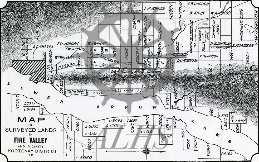
Map of surveyed lots in the Inonoaklin Valley (Fire Valley), Fauquier, and Applegrove, ca. 1909-10. Property owners in the Inonoaklin Valley are indicated by name. Map is taken from Fruit Farming at Edgewood British Columbia, an early 1910s promotional booklet marketing land at Edgewood to potential British settlers commissioned by James Ford and Douglas Ford. Published by Messrs. E. & H. Lumley.