Accession Num: 2012.003.181
Negative Code: J22-6
Extent:
Document Date: 1968-- - --
Donors: Estate of Ichiro Shiino
Creators: Ichiro Shiino
Keywords: 1960s, Arrow Lakes flooding (Columbia River Treaty), Celgar (Columbia Cellulose/Canadian Cellulose), Edwards house (Leary/Jordan/Massey), farms, Highway 6, Houdayer house (Rothwell Point), Nakusp waterfront levelling, Rothwell Bay, Rothwell Point, Rothwell Point wharf (modern), Spicer Farm, and Upper Arrow Lake
Locations: Nakusp
Physical Description:
1 b/w negative (60 mm)
Notes:
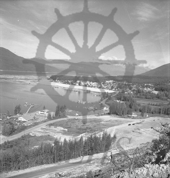
Bird's-eye view of Nakusp on Upper Arrow Lake, 1968. Waterfront at Nakusp has been levelled in advance of the flooding of the Arrow Lakes the following year by BC Hydro. Spicer Farm at right. Rene Houdayer and Ron Jordan houses at centre. Highway 6 runs through centre. New alignment of Highway 6 under construction at bottom. Celgar yard, offices, and wharf at left.