Paddle steamer wheel

Arrow Lakes
Historical Society

2007.008.1 Slewiskin Crick Area 7106 8035 app. 6 mile south of Nakusp B.C.

: 2007.008.1

:

:

: 1940-- - 1947--

: Val Morton

: Department of Energy Mines and Resources

: aerial image, Columbia River, McDonald Creek, Morton Ranch, The Narrows, and Upper Arrow Lake

: East Demars and West Demars

:
1 b/w photograph (21.6 x 24.1 cm)

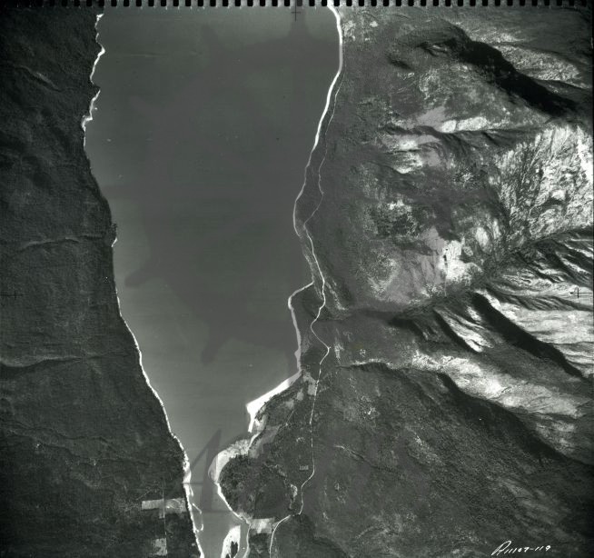
:
Department of Energy, Mines and Resources air photo of south end of Upper Arrow Lake (West Demars & East Demars) showing Slewiskin Creek entering lake and Lots 7106 & 8035 (Morton Ranch), taken 1947 or before. Photo no. A11107-119

Purchase Print

Purchased images are for personal use only and not for resale or redistribution. To obtain a licensing agreement please contact: [email protected].

Paper

Print Size/Format

Digital

Print Size/Format